

Caveat Emptor – meaning
Caveat Emptor is a Latin term that means “let the buyer beware.” Similar to the phrase “sold as is,” this term means that the Buyer assumes the risk that a product (or land) may fail to meet the Buyer’s expectations. In other words, the principle of caveat emptor serves as a warning that Buyers have no recourse with the Seller if the product does not meet their expectations.
This principle is particularly useful to neighbors who purchased or inherited their land AFTER the 2012 land redesignation at Chinook Ridge. The obligation to check the zoning on neighboring properties was/is the obligation of their realtor or themselves PRIOR to purchasing their property.
The term is actually part of a longer statement: Caveat emptor, quia ignorare non debuit quod jus alienum emit (“Let a purchaser beware, for he ought not to be ignorant of the nature of the property which he is buying from another party.”) The assumption is that Buyers will inspect and otherwise ensure that they are confident with the integrity (and zoning for nearby properties) of the product (or land, to which it often refers) before completing a transaction.
Caveat Emptor in Practice
Under the principle of caveat emptor, for example, a consumer who purchases a coffee mug and later discovers that it is the color blue and not red as they wanted. Had they inspected the mug prior to the sale, they may have changed their mind and not mad the purchase.
A New Land Redesignation Application
I am preparing to submit another Land Redesignation application for the north portion of my quarter to change it from the existing B-REC (Business-Recreational) to R-RUR (Rural- Residential with limited Agricultural pursuits) and subdivision into nine smaller parcels. This will be identical to the previous application, which was denied on February 13, 2024, but with more focus. The lots will be between 6 and 10 acres in size, allowing for a single-family dwelling, a small greenhouse, a small animal barn, and one or two horses; this is consistent with lot sizes in the nearby hamlet of Dogpound. Rocky View created the R-RUR designation to allow for a Tiny Home, which would be permitted if an approved development permit is granted. However, the HOA can prohibit them or deem them only for an elder or disabled family member and not for vacation rental use.
The lots will be serviced by a high-producing, potable community water well. There is a lack of small acreages available for people who wish to hobby farm (non-commercial). As you will see from the layout below, the subdivision will only require one approach onto Range Road 35. A HOA will manage garbage, dogs at large, driveway maintenance, noise and light pollution, recycling, and other items through the Bylaws created in preparation for Subdivision.
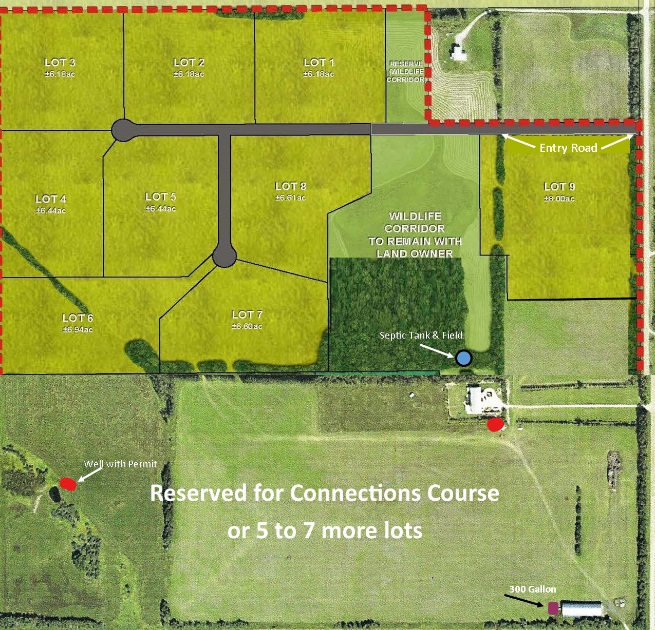
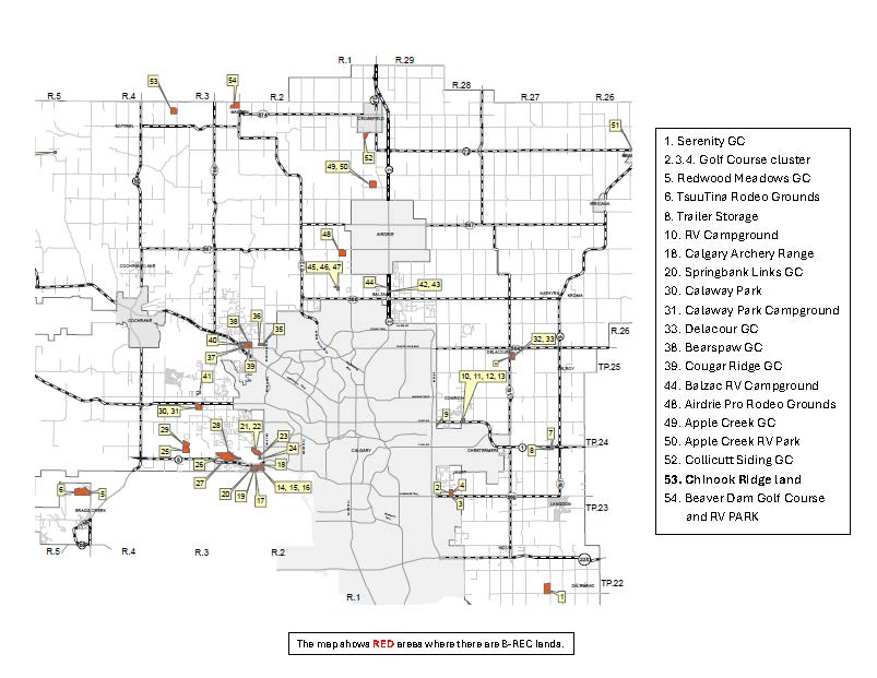
Due to neighbor concerns, there is no plan for a hotel, banquet hall, golf course, or RV Park. I am trying to meet them halfway despite a couple of them wanting to see me do nothing. I am not selling to you! These misguided efforts to thwart this application are going to result in a much bigger development with higher traffic, noise and water consumer than what I am proposing for example similar to those here on other B-REC lands in Rocky View:
WHY? Simple! Zoning Runs with the Land.
It is currently zoned B-REC and will stay that way and for that use until the owner changes it. You might reference the Municipal Government Act (MGA), which states this principle.
“Runs with the Land” is inherent, regardless of who owns it. This principle and the community’s misunderstanding of it resulted in a procedural error at the last hearing (among others). The new application will take steps to prevent this from reoccurring. I am offering to roll back the density of use to R-RUR for nine lots that are similar to what is found locally. It should be viewed as a kind gesture towards the neighbors taking ownership since the 2012 land change, however, if unsuccessful for any reason, it will result in a sale to the highest bidder for Business-Recreation use.
Since the last application, several changes have occurred.
1. Highway 574 (Twp Rd 294) is treated with the chemical bonding agent MG30, which eliminates dust by binding the particles.
2. Twp Rd 29.0 has been rebuilt and chip paved from Dog Pound east to the 766 secondary highway (Lochend Road).
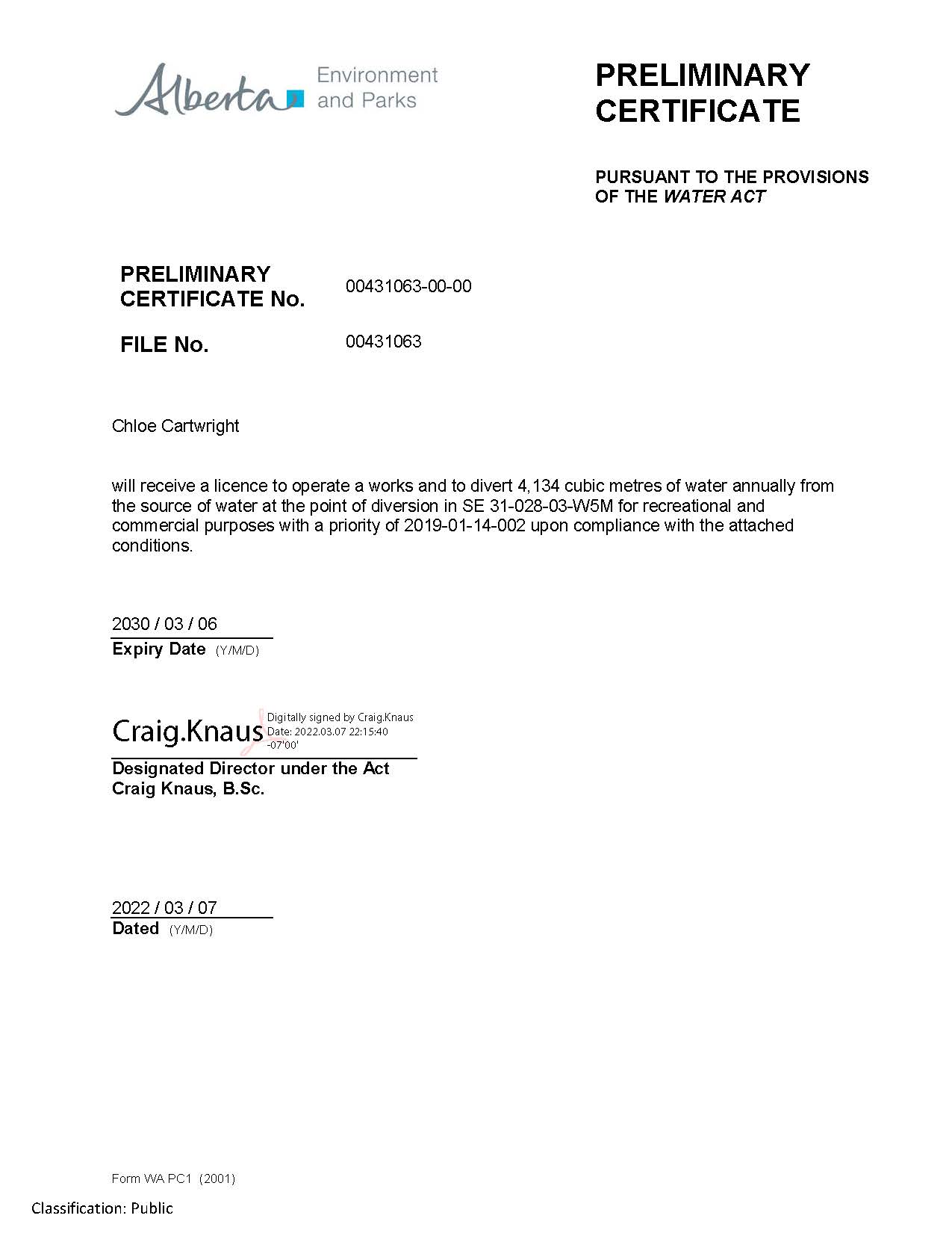
3. Rigorous testing of the aquifer proved that Chinook Ridge commercial wells are not connected to other wells in the vicinity. We have obtained a Preliminary Water Use Certificate from Alberta Environment and Parks.
4. We have updated the Traffic Impact Assessment that discusses improvements not required to Range Road 35 or Township Road 290, as volumes are within the current road specifications. It includes road widths for those concerned with this aspect.
Our hope is that the neighbors will be pleased with our new proposal. I have heard several comments expressing joy that there will be others in the neighborhood for riding (horses) with and more kids for other kids to play with. Others have cried out emotionally to Protect Our Agricultural Community. In the famous words of Herclitus:
 In other words, sometimes it is better to bend than to stay rigid and break.
Regarding the south portion of my land, I plan to use it to construct a Connections Course. The land is already zoned appropriately for that use and when complete will generate positive outcomes that are somewhat elusive to quantify but research will show signs of improved emotional and physical health in players, improved air quality, and increased wildlife habitat. It will only generate an increase of 6 vehicles per hour as one adult and one youth play the games shoulder to shoulder in pairs. Each pair starts 10 minutes behind the pair in front. This will be a development that takes years to finish, but I’m not going anywhere.
Feel free to contact me at 403 650 0888 with any questions or concerns. Invitations to Tea & Treats information sessions will be delivered to mailboxes within a 1.5-mile radius before March 31st. Please RSVP to ensure there are enough seats and treats. 😉
Alberta Environment and Parks – Water License
It is a license conditional to other matters but this is extremely good news and there were no appeals filed. One small step for man, one GIANT step for this woman. Stay tuned!
Audio from the 2012 Hearing – Brad Carter, Neighbor and Business Owner
For the benefit of those unable to attend – this 4-minute audio is of neighbor and business owner, Brad Carter, speaking in support of the Land Redesignation and eventual development of Chinook Ridge Lodge & Golf Course.
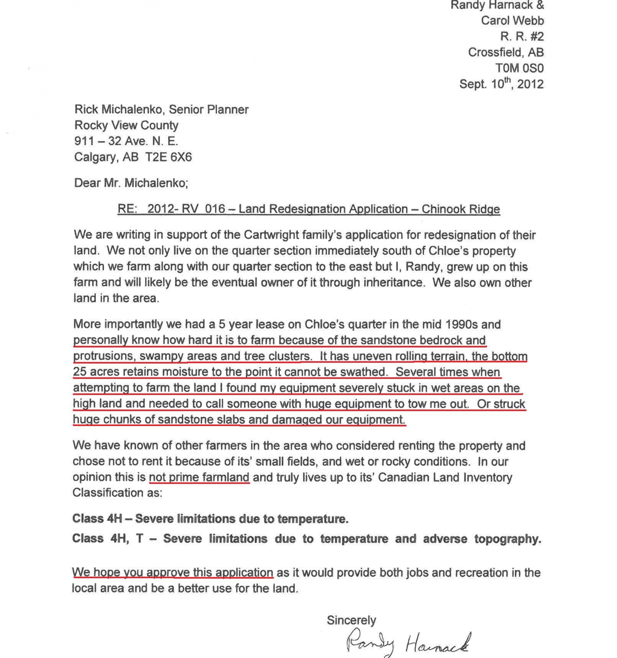
Neighbor, Randy Harnack’s Letter and Audio – 2012 Redesignation Hearing
Randy Harnack speaking and writing in support of both Land Redesignation and development of Chinook Ridge Lodge & Golf Course. Unfortunately, during the Redesignation Hearing, the Rocky View County staff lost the photographs discussed in this audio so those are unavailable but here is the 4-minute audio portion of the Hearing. The letter they are referring to is below and as Randy Harnack mentions in his letter there were other local area farmers who declined to rent the land due to its topography, small fields, and rock outcroppings or wetlands.
Audio of RVC’s Administration – purpose of Redesignation
This audio clip is extremely important as you can listen to the Administration’s 3-minute opening remarks and description of the purpose for the Redesignation application- to develop Chinook Ridge Lodge & Golf Course. The speaker is Rick Michelanko, RVC Planner. Chairing the Hearing was Reeve Ashdown.
Audio of John Ablett – Redesignation Hearing
Audio of John Ablett, business advisor, economic development specialist, and elected official speaking on behalf of the redesignation application and development of Chinook Ridge Lodge & Golf Course.
Audio of Kathy Fenton, local area Business Woman
This 5 1/2 minute audio is of Kathy Fenton, owner of Fenton Bus Lines, Fenton Quarter Horses, and local landowner speaking in support of the Redesignation of the land and development of Chinook Ridge Lodge & Golf Course.