Air Quality Monitor

I am pleased to be able to offer folks access to our Air Quality Monitor.  Just go to www.PurpleAir.com/map and scroll the map to the Dogpound area, Our monitor is marked with a green dot and the time scale comes up ‘CRAZ 001 Cartwright’.  CRAZ is Calgary Regional Air Zone.  This is a great way to view the air quality for those who have lung disorders or suffer from asthma.

Audio of John Ablett – Redesignation Hearing

Audio of John Ablett, business advisor, economic development specialist, and elected official speaking on behalf of the redesignation application and development of Chinook Ridge Lodge & Golf Course.

Audio of Kathy Fenton, local area Business Woman

This 5 1/2 minute audio is of Kathy Fenton, owner of Fenton Bus Lines, Fenton Quarter Horses, and local landowner speaking in support of the Redesignation of the land and development of Chinook Ridge Lodge & Golf Course.

Not Farmland – huge sandstone slabs

The sandstone slabs on this post all came from an area measuring 40′ X 80′ on my land, they were 3 to 6″ from the surface of the soil.  Slabs like this run throughout the land.  Some are at the surface, and some just below.  The only way they could be moved was with a large track hoe.  It may be difficult to get a perspective on size.  The ones standing upright – like the first two photos are half-buried in the ground to stabilize them.


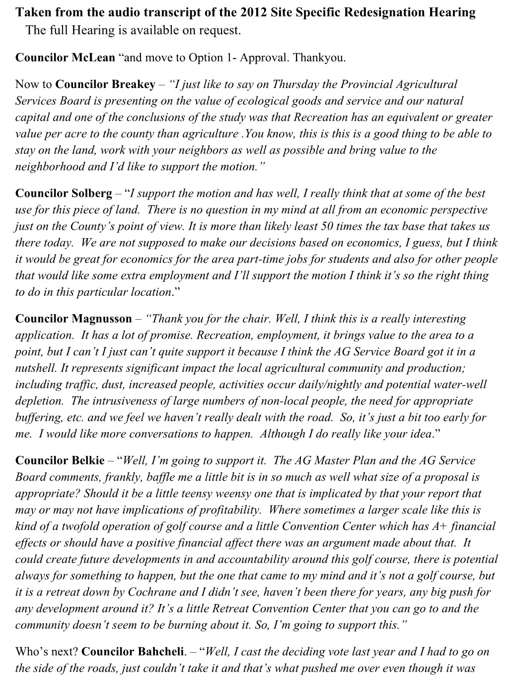
This is my center island there are 5 slabs in this pile.  The one in the front left measures 4′ by 5′ by 8″ thick ABOVE ground.  Half of this slab is buried below ground to stabilize it.  The one on top is 4′ by 3′. also 8″ thick. The one on the top left measures about 8′ by 4′.

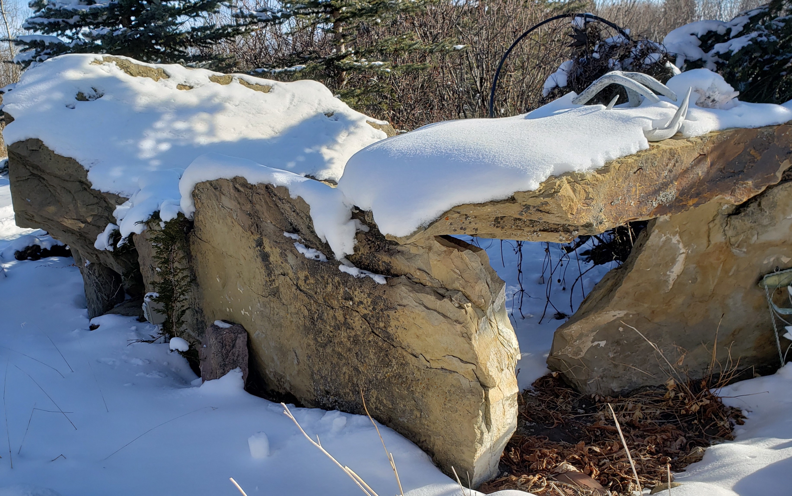
Also in the center island.  This is a small one measuring about 4.5′ wide.  It is 7′ long but half of it is buried to stabilize it.

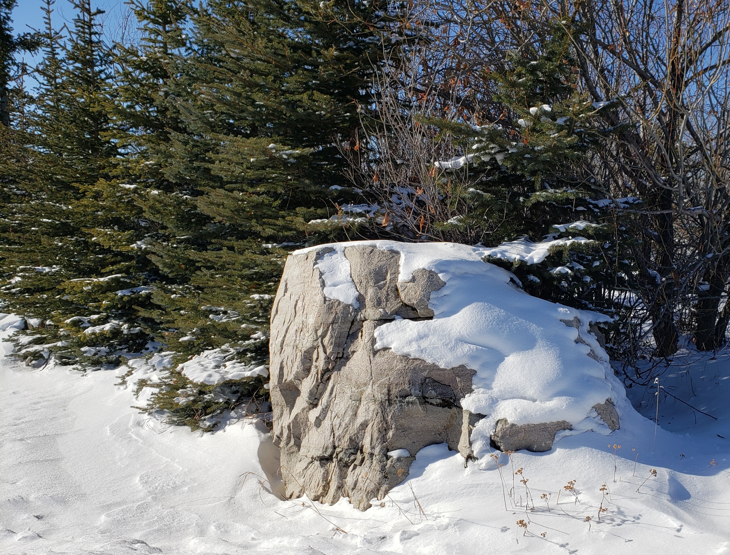
The sandstone boulder sits at the entrance to my yard and came from the same source as those above.  It measures 4′ x 4′ overall and is about 3′ thick.

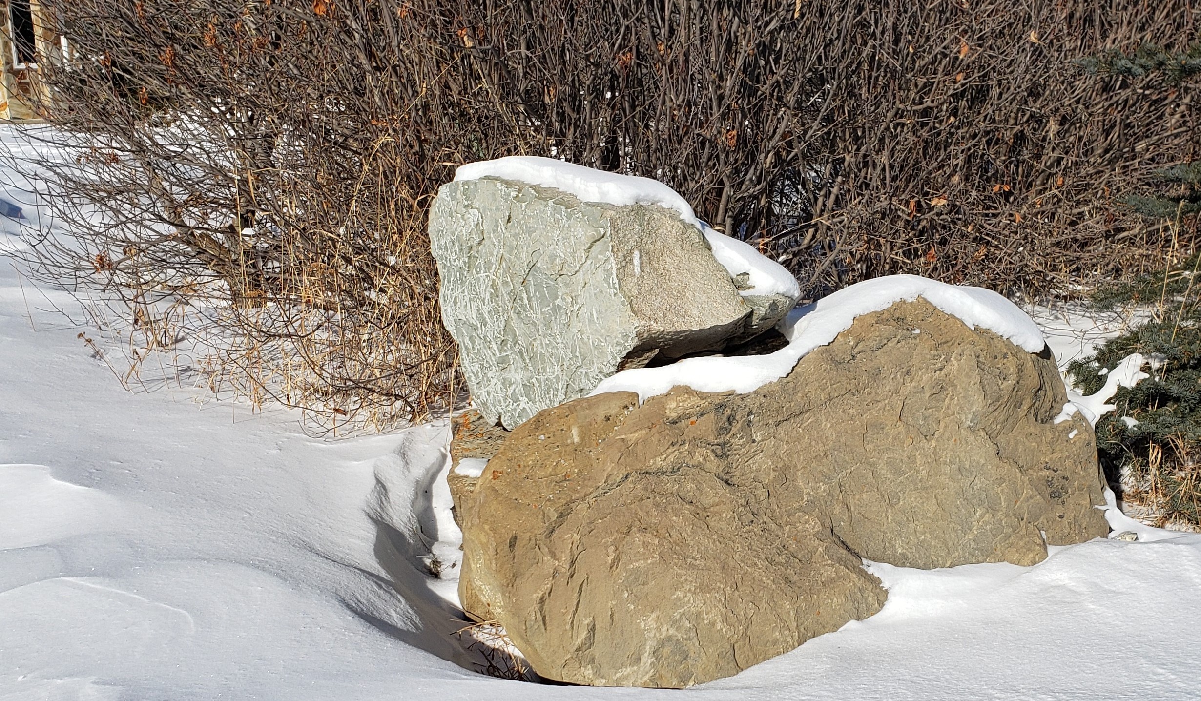
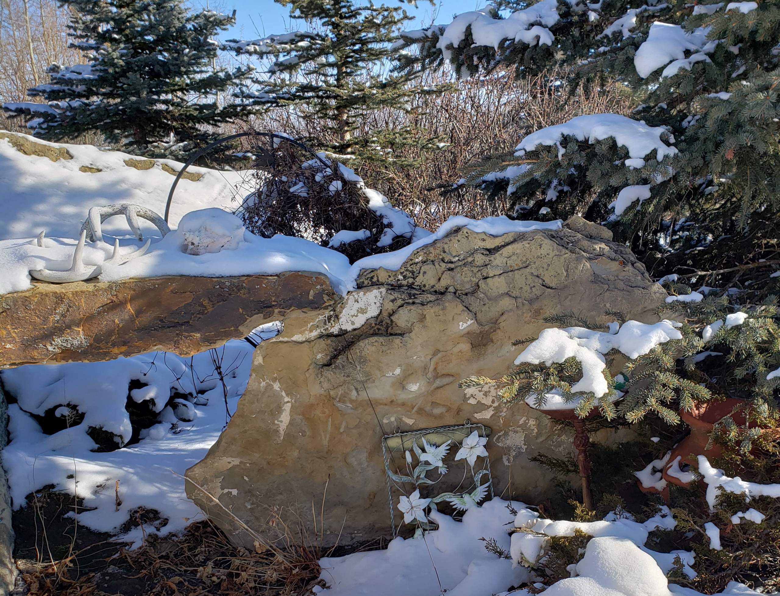
These are relatively small. the bottom measuring 3′ by 1.5′ and 1.5 by 1.75.  Same source.  These boulders run throughout the land making it impossible to farm or it wrecks the machinery.

Thank you Neighbors!

Thank you neighbors who have sent in your Feedback Forms, much appreciated.  Hopefully, those remaining will send theirs in as well.  Your voice is important!

Thank you to the handful of neighbors who contacted me with questions.  If you have them then others likely do as well so I thought I would post the answers here:

1.  Where will the sewage go from the event facility/hotel?
Initially into a large holding tank and be hauled away. Later when the play course is built it will go into a treatment plant and be dispersed below the surface to water the tees, greens, and flower beds.  It will be similar to the system they use in Bragg Creek where sewage is treated and becomes purified to a degree it can be drained into the river.

2. Is the money to build this coming from out of country investors?
No. it is my money, and I am borrowing from Canadian banks.

3.  Who is going to maintain the roads?
The respective County/Province as the case may be.  There are ‘conditions and agreements’ that will be in place where I am required to make either contribution, pay for costs and the increased taxes handle the rest.  This is done at the Conditional Permit stage so it will depend on which option is put forth.

4. What happens if there are too many occupants?
Then the Business gets fined by the County and even the Province.  It is not in our or our guest’s best interests to be over occupancy limits.  The booking software will have restrictions and our gate attendant will prevent too many people from coming in, and prevent impaired folks from leaving.

5. Do you intend to use grant money for this operation?
Not intending to as this is a business operation but there may be opportunities for corporations to use the facility for employee -team-building events, plant trees and earn corporate off-set credits.  Other organizations may apply for grants from agencies to be able to use our facility for specific purposes.

6. How do you expect those 25-foot-wide RVs to travel down a 24-foot-wide road?
Sorry, you must not be an RV’er. Those rigs are only 8 feet wide. My RV stalls are 25 feet wide to allow campers to fully open up their slide-outs and pop-ups.  But they don’t travel down the roads with those out, transport regulations allow 8-foot-wide vehicles in Canada, one of the states allows 8.5 feet.

7. Why were you able to get Rocky View County’s permission for the land-use change when others in both Rocky View and Mountain View have not?
It wasn’t easy by any means, it took two tries before Council, but before that, I first, had to determine the Canadian Land Inventory classification for my land – which is severely restricted for crops due to topography.  Which here means a fairly steep valley that slopes to the west, rocky outcroppings, wetlands, and lack of heat. (the sun is blocked because of the valley) so the soil stays moist and impossible to drive large machinery for seeding and harvesting.  Second, I had to make sure the land had access to enough water for a significantly sized commercial water registration.  Both Stantec and Solstice did the requisite pump tests and data collection for this and confirmed there is sufficient water – high-quality water that will not deplete anyone else’s well. Third, the land lies in the Red Deer River Sub-basin.  Then commissioned the Biophysical Impact Assessment, Environmental Assessment, Traffic Impact Assessment, Integrated Water Management Plan, and so on, at considerable cost.  So, the short answer to the question above is – I hired professionals!
Why others in RVC and MVC have not been successful is difficult for me to say but I would have to ask if they went through the same checklist of requirements on land that was not prime farmland?  Then if the land classification and water availability were favorable did they hire professionals?  Or did they just ask the county officials and get an unfavorable response and not go further.  I don’t know as there are a lot of variables and the counties process things differently and a large number of legislative pieces to negotiate.

8. Is this a public facility or a private facility and can the community use it?
Good question. It was designed to be a ‘closed gate’ facility. In other words, initially, I wanted to have it open for events like weddings, corporate retreats, family reunions, etc., and closed when not booked for an event.  However, some of the area residents pointed out that they would like to use it – especially the dining room and the spa, oh, but what if I want to bring my family who is visiting from afar there with their RV, can’t we park it there?  Do you see the dilemma?  Yet if I say it is only for ‘events’ and neighbors – then there will be a discussion about what constitutes a ‘neighbor’.  I just want to open, take bookings and work with the community on how it can best meet the needs of the community – stay responsive.

9. What about noise and the potential for fires?  How are you going to handle that?
In response to neighbor concerns, I have revised the current ‘Proposals’ (see Proposals tab) so there is no longer a roof-top patio, the events will be held strictly indoors.  At the same time, I decided no outdoor fires/firepits.

10. What about Wildlife?
If you review Proposals 1, 3, and 4 show wildlife areas (all of #1) but the existing corridors are reserved and shaded in #3 and #4.  There will be no development in those areas allowing for wildlife to use their normal pathways.  If anything all the proposals will enhance tree coverage and wildlife habitat.

11. Your hayshed is quite an eyesore, what are you going to do about that?
Yes, sorry about that. It was getting pretty worn out earlier but the wind storm of November 21, 2020, really shredded it.  It has been too cold to take it all the way down so that will have to wait a while.  I will decide what material to recover it with once the community consultation process ends and I have a new development permit.  The options are to clad with metal, powder coat it and close the ends in or recover it with a new fabric tarp.

2009 – 2012 Brochure.

The Brochure (below) is what we sent out to neighbors and interested parties and passed out at our open house.  It took a couple of revisions while we tried to make it concise but informative.  The original version was much wordier.

It appears some of the original residents sold their properties and may not have informed new owners of the development plans for this land.  In some cases, they may have shared partial information or the information that was important to them while leaving out some other details.  This link will take you to the Brochure we used from 2009 to 2012 and delivered to neighbors within a 3 km radius.  It formed the Vision, although operations were fine-tuned and sometimes changed due to the neighbor’s concerns.

Click pages to turn              2009 Flipbook

Original Concept Plans

This was the original design from the 2012 Land Redesignation and 2013 Development Permit applications. In my 2018 application, I changed the design to a castle so as to not compete with the Mountain View Heritage Barn near Cremona and moved it to a lower elevation surrounded by trees.  Not everybody was on board with that plan.  That didn’t work!
I may go back to this design for 2021 but change the exterior finish.

Note the walkout faces west.  In the lower level is a spike/snack bar, spas, and meeting rooms all easily accessed by the public; neighbors are welcome to use this area.

The professionally designed 18-hole course by Rod Whitman was part of the 2012 plan.

Back to the drawing board:)

So the neighborhood didn’t like the most recent plan for a Castle, RV Park, and a 9-hole course (pictured below). Not sure these folks will like any changes but must hope they do. I am preparing three alternative plans for them to review. I am just waiting for concept plans which should be out next week.  This would have been ideal for bringing tourists into the area who would then explore other tourism venues and spend tourist dollars at local restaurants, shops, etc.


Neighborhood Support for Development

Letters From People in Support of Chinook Ridge

Prior to the Land Redesignation Hearing Chinook Ridge received 105 letters of support from most where from neighbors (Dogpount to Bottrel) but also others who wanted to visit and use the facility.  At the time of the Hearing over 80 people came out to stand in support at Council Chambers, they had to bring in extra seating.  Some drove themselves to the Hearing while others rode in a bus I provided – due to lack of parking at the old County office.

An additional 56 letters of support were written by business owners and employees in and around Water Valley and Cremona areas, people who realized what economic benefits tourists bring to the area.

Unfortunately, not everyone has this vision of economic vitality, rather they exhibit a negative attitude towards ‘new-comers, tourists, etc’ in a ‘not in my back-yard’ fashion.

AEP & Ground Water (well) Registration

Now deep into the registration process – the application was made almost 3 years ago – we are finalizing the process.  AEP wanted an updated Q20 – consisting of 48 hours of pumping and 48 hours of recovery.

“A 48-hour pumping test was conducted on Chinook Ridge’s supply well (GIC ID 2090656) from September 15 – 19, 2020 by personnel from Wild Rose Water Wells. Water levels were measured in Chinook Ridge’s supply well, two observation wells on Chinook Ridge property, one well on Jim Davies’ property and one well on Karen Singer’s property.”

The results were that the Singer well is not connected to the Chinook Ridge well.  The Davies well may or may not be connected as the pump test results showed no correlation in drawdown.  The full report can be viewed under the ‘2020 Water Rpt‘ tab on this website.

Substituting in the above values a 20-year safe yield (020) of 135.4 m3/day (20.6 imperial gallons per minute or 49,455 m3/year) is calculated. The analysis indicates the well is capable of supplying water at a rate of 20.6 igpm, which is greater than the tested rate of 12.0 igpm. The safe yield for the well is nearly double the license application volume of 26,982 m3/year, allowing for potential growth in water demand at a later date.